User's Guide
Upon arriving at the SADCO home page the user is presented with the option of accessing Marine or Voluntary Observing Ships (VOS) data. Either two can be accessed by clicking on the corresponding icon or by choosing the desired option from the ‘Data Access’ dropdown.

Marine Data
Filtering
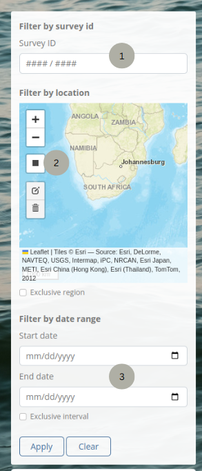
The marine data page initially has an unfiltered list of all the Marine data surveys. There is a filter panel to the left of the list with filtering options.
Filter by Survey ID (1)
Use this option if the Survey ID is known. Only part of the Survey ID can also be filled in and matching surveys will be displayed
Filter by Location (2)
Use the “Draw a Rectangle” option on the map to draw a bounding box around the required area. The “Exclusive Region” checkbox can also be selected to exclude the specified area from the search results.
If any of the stations that belong to a survey appear within the specified area, that entire survey will be displayed in the results list.
Filter by date range (3)
Select a start and end date to show surveys from within those dates. The “Exclusive Interval” option can also be checked to show only the surveys that fall outside of that date range.
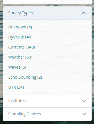
Survey Types, Institutes and Sampling Devices
A list of Survey Types, Institutes or Sampling Devices appears on the left below the first filtering panel. Either of the lists can be expanded or collapsed. The list displays all the items in that list along with the number of records that conform to that list in brackets next to the item. Click on an item to filter the list according to that item.

Viewing/Downloading Specific Survey
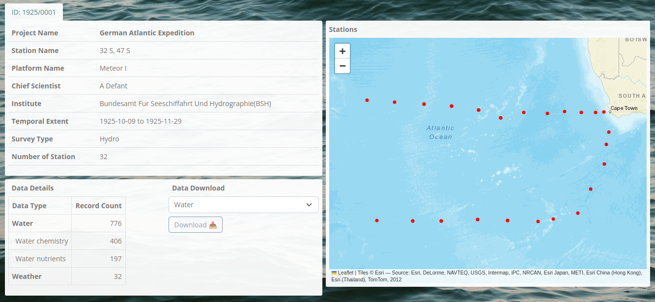
Once a specific survey has been found using the filtering tools, it can be selected by clicking on the corresponding ‘ID’ from the filtered list. High level data specific to that survey and unique to the Survey Type will be displayed.

Downloading
A user needs to be logged-in in order to download data. Click the ‘login’ button in the top right corner in order to log in or register. Once logged in click the ‘Download’ button to download the data specific to that survey. For the ‘hydro’ data type, a data type needs to be selected from the dropdown to download that specific data type that was collected as a part of that survey. The data will be downloaded in a csv file format.

VOS Data
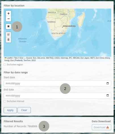
VOS data does not contain header data for specific voyages. There is therefore no filtered list, just a display of how many records are filtered.
Filtering
VOS data can be filtered by inclusive and exclusive physical and temporal extent. Filtering by physical extent can be done by selecting the ‘draw a rectangle’ icon (1) on the map and drawing a rectangle around the area in question. Filtering by temporal extent can be done by selecting a start and an end date (2). Exclusive region or interval can be chosen to show records that fall outside the chosen bounds.
Downloading
Once the filters have been chosen, click ‘Apply’ to apply the filter. The record number (3) will be updated and then the data can be downloaded. As with the Marine Data, the user needs to be logged-in in order to download.